Experiences on the voyage of the First Fleet
Experiences on the voyage of the First Fleet
How the development of navigational instruments influenced global navigation
Navigational instruments
Overview
The development of navigational instruments significantly influenced global navigation by improving the accuracy and reliability of sea travel. Early sailors relied on basic tools, but new instruments allowed explorers to determine their position more precisely. For example, the sextant and astrolabe enabled sailors to calculate latitude by measuring the angle of the sun or stars. The magnetic compass helped sailors identify direction, even when land was not visible. Later, the invention of the marine chronometer allowed sailors to determine longitude, which had previously been very difficult.
These innovations transformed navigation by making long-distance voyages safer and more efficient. As a result, explorers such as James Cook were able to map new lands with greater precision, leading to increased global exploration, trade, and colonisation.
Compass
~
The magnetic compass uses a magnetised needle to align with the Earth’s magnetic field and indicate direction (north, south, east and west).
History
The compass was first developed in ancient China around the 11th–12th century. Early versions used a magnetised lodestone and were later adapted for maritime navigation.
By the 13th century, the compass had spread to Europe and the Islamic world.
It became a key tool during the Age of Exploration, used by sailors navigating across open oceans.
How it influenced global navigation
The development of the compass significantly transformed global navigation by improving the accuracy, reliability, and efficiency of sea travel.

Direction and orientation
The compass allowed sailors to determine cardinal directions even when land was not visible and weather conditions were poor. This reduced reliance on landmarks and coastal navigation.
Exploration and mapping
Explorers such as James Cook used compasses alongside other instruments to accurately chart coastlines and improve cartography (map-making). This contributed to expansion of global trade routes and European exploration and colonisation
Why it was important
The compass was one of the first instruments to make navigation more predictable, and less dependent on experience alone.
It revolutionised maritime travel by allowing sailors to navigate with greater confidence and precision.
Sextant
~

The sextant significantly improved the accuracy and reliability of navigation by allowing sailors to determine their position using celestial navigation. This reduced uncertainty and enabled more efficient long-distance voyages across open oceans.
By providing consistent measurements of latitude, the sextant helped sailors navigate with greater confidence, contributing to global exploration, trade, and colonisation.
A sextant is used to measure the angle between a celestial object (such as the sun or stars) and the horizon. This measurement allows sailors to calculate their latitude, which is their position north or south of the Equator.
History
The sextant was developed in the 18th century, improving on earlier instruments such as the astrolabe and cross-staff. It became widely used by European sailors during the Age of Exploration and was a key tool on voyages such as those led by James Cook.
The sextant was more advanced because it used mirrors to improve precision, making it easier to take accurate readings at sea.
How it influenced global navigation
Direction and orientation
While the sextant did not show direction like a compass, it played a crucial role in determining position. By measuring the angle of the sun at midday or the position of stars, sailors could calculate their latitude and understand where they were on the globe.
This worked in combination with the compass (direction), and chronometer (longitude).
Exploration and mapping
The sextant enabled explorers to make more accurate observations, which improved cartography (map-making). Voyages could be recorded with greater precision, allowing coastlines and new lands to be mapped more reliably.
Explorers such as James Cook used sextants to produce detailed and accurate maps of the Pacific, which were used for future navigation.
Why it was important
The sextant was important because it made navigation more scientific and systematic. Instead of relying only on experience or guesswork, sailors could use mathematical calculations to determine their position. This reduced the risk of getting lost, made long-distance travel safer, and supported the expansion of global exploration
~
Early mapping

Cartography is the practice of creating maps to represent the Earth’s surface. Early maps were used by sailors and explorers to record coastlines, routes, and important geographical features.
History
Early mapping developed over thousands of years, with contributions from ancient Greek, Roman, and Islamic scholars. However, mapping improved significantly during the Age of Exploration (15th–18th centuries) as sailors began using navigational instruments such as the compass, astrolabe, and sextant.
As explorers travelled further, maps became more detailed and began to include latitude and longitude, allowing for more accurate representation of the world.
How it influenced global navigation
Early mapping significantly improved the accuracy and reliability of navigation by providing visual representations of routes and locations. Maps allowed sailors to plan voyages more efficiently and avoid previously recorded hazards.
This contributed to expansion of global trade routes, increased exploration, and safer long-distance travel.
Direction and orientation
Maps helped sailors understand direction and position by showing:
-
Cardinal directions (north, south, east, west)
-
Coastlines and landmarks
-
Coordinates such as latitude and longitude
When used with navigational instruments, maps allowed sailors to determine where they were and where they needed to go.
Exploration and mapping
As explorers such as James Cook travelled to new regions, they recorded observations and measurements to create more accurate maps. This process improved cartography and allowed future sailors to navigate these areas more easily.
Maps became increasingly systematic and precise, reflecting the growing use of scientific instruments.
Why it was important
Early mapping was important because it transformed navigation into a more organised and scientific process. Instead of relying only on memory or experience, sailors could use maps to guide their journeys. This reduced uncertainty, improved safety, and supported global exploration and colonisation.
~
Astrolabe

An astrolabe is used to measure the height of the sun or stars above the horizon. Sailors used this information to calculate their latitude, helping them determine their position at sea.
History
The astrolabe was developed in the ancient world, with important contributions from Greek astronomers and later refined by Islamic scholars during the Middle Ages. It was introduced to European sailors and became widely used from the 15th century during early ocean exploration.
Before the sextant, the astrolabe was one of the most important tools for celestial navigation, although it was more difficult to use accurately on a moving ship.
How it influenced global navigation
The astrolabe significantly improved the ability of sailors to navigate using the sun and stars, making long-distance sea travel more reliable. It allowed sailors to move beyond coastal navigation and travel across open oceans with greater confidence.
This contributed to the expansion of global exploration, trade routes, and European contact with new regions.
Marine chronometer
Direction and orientation
Like the sextant, the astrolabe did not show direction but helped determine position. By measuring the angle of celestial objects, sailors could calculate their latitude and understand their location on the Earth.
It worked alongside the compass (direction), and other observational tools.
Exploration and mapping
The astrolabe enabled explorers to make more systematic observations of their position, which improved early cartography. Although less precise than later instruments, it allowed for more accurate recording of voyages and contributed to the mapping of new lands.
Why it was important
The astrolabe was important because it was one of the first instruments to make navigation more scientific rather than based only on experience. It laid the foundation for later instruments like the sextant, helping to improve the accuracy of navigation over time.
This supported safer voyages, expansion of exploration and development of navigation techniques.
~

A marine chronometer is a highly accurate clock used at sea to measure time. It allowed sailors to calculate their longitude, which is their position east or west on the Earth.
History
The marine chronometer was developed in the 18th century, most famously by John Harrison, who created a clock that could keep precise time despite the movement of a ship.
Before its invention, sailors could determine latitude but struggled to calculate longitude accurately. The chronometer solved this problem by allowing sailors to compare the time at sea with a fixed reference point (such as Greenwich, England).
How it influenced global navigation
The marine chronometer significantly improved the accuracy and reliability of navigation by enabling sailors to calculate longitude precisely. This reduced navigational errors and made long-distance voyages safer and more efficient.
It was a major breakthrough that transformed global navigation, supported safer trade routes, and enabled more precise exploration.
~
Direction and orientation
The marine chronometer did not show direction, but it was essential for determining position. By comparing local time (based on the sun) with the time on the chronometer, sailors could calculate their longitude.
It worked in combination with the sextant (latitude), and the compass (direction).
Exploration and mapping
The chronometer allowed explorers to record their exact position with much greater precision, which greatly improved cartography. Maps became more accurate, and previously unknown areas could be charted more reliably. Explorers such as James Cook used timekeeping instruments to improve mapping of the Pacific.
Why it was important
The marine chronometer was important because it solved the long-standing problem of determining longitude, making navigation far more scientific and dependable. This reduced the risk of shipwrecks, improved global trade and travel, and marked a major advancement in navigation technology
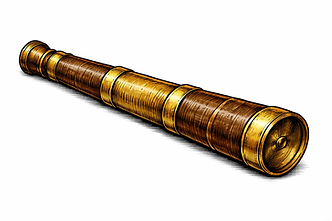
Spyglass (telescope)
A spyglass is a simple optical instrument used to magnify distant objects. Sailors used it to observe land, ships, and coastlines from far away, helping them navigate safely.
History
The spyglass was developed in the early 17th century, following the invention of the telescope in Europe. It was quickly adapted for maritime use, becoming a standard tool for sailors and explorers.
Unlike other navigational instruments, the spyglass did not measure position mathematically. Instead, it supported navigation through improved observation.
How it influenced global navigation
The spyglass improved navigation by increasing sailors’ ability to identify and interpret distant features. This made voyages safer and more efficient, particularly when approaching land or navigating busy sea routes.
It helped sailors detect hazards such as reefs or rocks, locate land earlier, and identify other ships
How it influenced global navigation
The spyglass improved navigation by increasing sailors’ ability to identify and interpret distant features. This made voyages safer and more efficient, particularly when approaching land or navigating busy sea routes.
It helped sailors detect hazards such as reefs or rocks, locate land earlier, and identify other ships.