Connecting Terra Australis to the world using maps and images as sources of evidence
Macassan traders
Chart: Route of trepang trade from Macassar north to Arnhem Land and China
Source: Unknown
Source type: Possibly secondary

The route of the trepang trade from Macassar north to Arnhem Land and China.
Why this is an important source
This map is important because it shows that northern Australia was part of an established international trade network long before European settlement, highlighting early connections through trade and cultural exchange rather than exploration alone.
This map shows the trade routes of Macassan sailors travelling from Makassar (Sulawesi, Indonesia) to northern Australia (Arnhem Land), and north to China.
-
The dotted lines show the sea routes used by Macassan traders
-
It also shows the monsoon winds:
-
July winds → carried traders to Australia
-
January winds → carried them back to Indonesia
-
-
Key locations include:
-
Marege (northern Australia)
-
Gulf of Carpentaria
-
Makassar
-
China
-
These journeys were made to collect trepang (sea cucumber), which was traded with China.
Voyage chapters
Voyage chapters

Source: Aboriginal rock art
Location: Unknown
Artist: Unknown
About:
This image likely shows an Aboriginal rock painting of a boat or canoe, possibly from northern Australia (such as the Kimberley region). These kinds of paintings often show contact with visitors like Macassan traders or Europeans.
Source: Aboriginal bark painting
Artist: Minimini Numalkiyiya Mamarika
Date: Circa 1930
About:
Bark painting of Macassan prau. Courtesy: Art Gallery of South Australia.

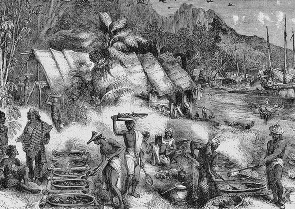
Source: National Museum of Australia
Artist: HS Melville
Date: 1845
About:
Macassans at Victoria, Port Essington (Northern Territory), 1845